Description
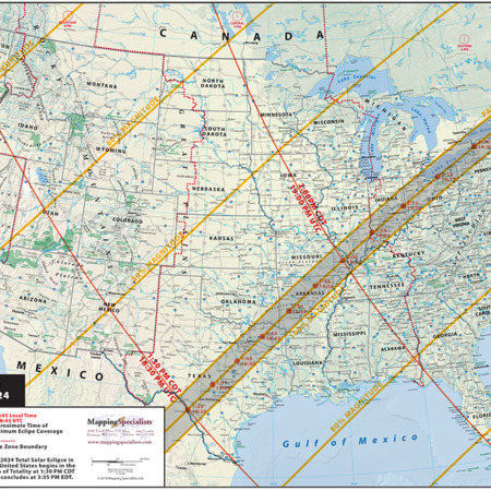
Two-sided series of maps and diagrams showing the path of the April 8, 2024 total solar eclipse. U.S. map shows local times and eclipse magnitudes along the path. Reverse side includes a map of travel distances and times, a chart of eclipse times for major cities along the path, a map of solar eclipses in the U.S. in the 21st century, and graphic information about the eclipse. Measures 17×11 inches, laminated.
This map is customizable and available for licensing! Add your logo, custom locations, or anything else you want to show. Reconfigure and create your own custom product. Contact us to obtain a quote for your customized map.
Made in the USA using official NASA astronomical data.

